December 2015 Statistics
|
Temperature
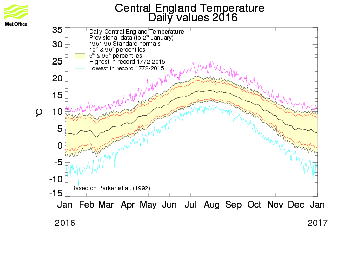
December was the warmest on record for most of England and Wales. The average CET (Central England Temperature) was 9.6C, that’s 5C above the 1981-2010 average. This is one of the largest anomalies of monthly temperature ever measured in the UK. With the previous warmest Decembers had a mean temperature 8.1C (in 1934 and 1974). Mean temperatures Scotland were 3C above average Source uk met office |
Rainfall
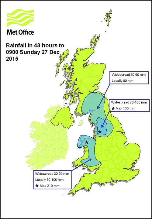
December was also one of the wettest months ever recorded in southern Scotland, Northern England and Gwynedd. Capel Curig in Snowdonia received over 1mt of rain during the month, At Eskdalemuir in southern Scotland, the month’s total of 550mm is the wettest month there in over a century of records. The average England and Wales rainfall total amounted to 170mm (198% of average) Regional variation in Wales and NW England with around three times the average rain fell. The wettest city was Glasgow with an unprecedented 370mm. Honister Pass, Cumbria set a new record for 24-hour rainfall in the UK with a total of 341mm in the 24 hours to 6pm on 5 December.
December was also one of the wettest months ever recorded in southern Scotland, Northern England and Gwynedd. Capel Curig in Snowdonia received over 1mt of rain during the month, At Eskdalemuir in southern Scotland, the month’s total of 550mm is the wettest month there in over a century of records. The average England and Wales rainfall total amounted to 170mm (198% of average) Regional variation in Wales and NW England with around three times the average rain fell. The wettest city was Glasgow with an unprecedented 370mm. Honister Pass, Cumbria set a new record for 24-hour rainfall in the UK with a total of 341mm in the 24 hours to 6pm on 5 December.
Sunshine
December was also noted for grey skies as well as high temperatures, especially in England and Wales where sunshine averaged 28 hours. Other areas had between 50 and 70% of sunshine, though eastern Scotland had around average amounts with over 40 hours in places. While Jersey was the sunniest location with 52 hours.
December was also noted for grey skies as well as high temperatures, especially in England and Wales where sunshine averaged 28 hours. Other areas had between 50 and 70% of sunshine, though eastern Scotland had around average amounts with over 40 hours in places. While Jersey was the sunniest location with 52 hours.
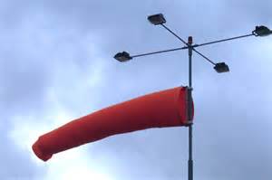
Wind
December was also noted by a relentless & persistent strong south-westerly airflow. The named storms Eva and Frank gave strong winds on the 23rd and 29th-30th. Winds at low-le December was characterised by a remarkably persistent and quite strong south-westerly airflow. The named storms Eva and Frank gave strong winds on the 23rd and 29th-30th. And even winds at ground level gusted to 82mph at Benbecula on the 29th.
December was also noted by a relentless & persistent strong south-westerly airflow. The named storms Eva and Frank gave strong winds on the 23rd and 29th-30th. Winds at low-le December was characterised by a remarkably persistent and quite strong south-westerly airflow. The named storms Eva and Frank gave strong winds on the 23rd and 29th-30th. And even winds at ground level gusted to 82mph at Benbecula on the 29th.
What’s instore next?
There are signs now of the pacific starting to very slowly to cool this will have the effect of slowing down the jet stream and allowing it to buckle one part going north the other
( main one) going south with the possibility of ether Scandinavian high building or a polar vortex (must likely) to develop all of which are capable of delivering very cold and snowy winter.
The forecast for the next 2 months are pretty much in keeping with my LRF (Dated 6th September 2015) in as much as I am still expecting very cold spells in January with some places seeing a lot of snow but with milder interludes, We have to wait till February and March before we see any prolonged cold spell.
Looking back at my long range autumn and winter forecast for 2015/16 the general theme I am very pleased with so far, I was forecasting heavy rain and strong winds although I did not expect such heavy rainfall, and of course most of us miss out on a white Christmas and New Year eve, As I have said in previous LRF because I am forecasting so far ahead I always give myself 10 days lee way so my NYE forecast sell by date would be 10th of Jan and so on and remember as always "it’s just for fun".
We will have to wait and see, please keep coming back to my website metjeffuk.com also you can find us on Facebook and twitter.
Interesting and exciting times ahead ;)
Hope the sun shines for you but….
Whatever the weather enjoy it!
metjeffuk
4-01-2016
