HI JEFF FROM Metjeffuk
LAST YEAR I SUFFERED A HEART ❤ ATTACK THIS MEANT I HAD JUST 19% OF MY LEFT SIDE OF MY HEART WORKING WHICH HAS KEPT ME FROM DOING MOST THINGS.
I HAVE ALWAYS HAD A PASSION FOR THE WEATHER FROM AN EARLY AGE I HAVE BEEN FORECASTING THE WEATHER FOR NOW FOR OVER 50 YEARS, W4K PROVIDES THE WEATHER FORECAST FOR MANY EVENTS IN CORNWALL, ONE OF WHICH IS THE MARTIN JENNINGS BIKE RUN DAVE SAUNBY THE ORGANIZER SAID "WE RELY ON JEFF'S FORECAST BECAUSE "JEFF IS SO ACCURATE."
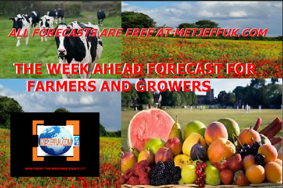
METJEFFUK PROVIDES A WEEKLY ACCURATE VIDEO WEATHER FORECAST FOR FARMERS AND GROWERS SOMETIMES I JUST NEED KEEPING AWAKE THAT MEANS DRINKING PLENTY OF COFFEE AND TEA DECAFE OF COURSE SO IF YOU WOULD LIKE TO BUY ME A COFFEE JUST CLICK ON THE LINK CHEERS JEFF
https://www.buymeacoffee.com/weather4kernow
LAST YEAR I SUFFERED A HEART ❤ ATTACK THIS MEANT I HAD JUST 19% OF MY LEFT SIDE OF MY HEART WORKING WHICH HAS KEPT ME FROM DOING MOST THINGS.
I HAVE ALWAYS HAD A PASSION FOR THE WEATHER FROM AN EARLY AGE I HAVE BEEN FORECASTING THE WEATHER FOR NOW FOR OVER 50 YEARS, W4K PROVIDES THE WEATHER FORECAST FOR MANY EVENTS IN CORNWALL, ONE OF WHICH IS THE MARTIN JENNINGS BIKE RUN DAVE SAUNBY THE ORGANIZER SAID "WE RELY ON JEFF'S FORECAST BECAUSE "JEFF IS SO ACCURATE."
METJEFFUK PROVIDES A WEEKLY ACCURATE VIDEO WEATHER FORECAST FOR FARMERS AND GROWERS SOMETIMES I JUST NEED KEEPING AWAKE THAT MEANS DRINKING PLENTY OF COFFEE AND TEA DECAFE OF COURSE SO IF YOU WOULD LIKE TO BUY ME A COFFEE JUST CLICK ON THE LINK CHEERS JEFF
https://www.buymeacoffee.com/weather4kernow
|
|
|
|
|
|
|
Buy METJEFF A Coffee!
About Metjeffuk.com/Weather4Kernow We have a small donation page. As you are maybe aware, I (Jeff) recently had a heart attack which has as left me with a severe issues with my heart and therefore classed me as having a disability, I enjoy Weather Forecasting as a hobby having been forecasting the weather for over 50 years I decided that Farmers, Cornwall and the Isles of Scilly were always left out when it came media and TV weather forecasts. I would like Metjeffuk.com and Weather4Kernow become a viable and sustainable business. The voluntary work on social media will always continue to remain free but I realise that I should be paid for the service I provide. So, if you feel I am worthy on advancing our services to make us become a sustainable business then why not donate a £1 for a coffee because with the hours I work, we most definitely need the caffeen. |
|
https://www.paypal.com/donate/?hosted_button_id=E6TZ8R6BQBVYA |
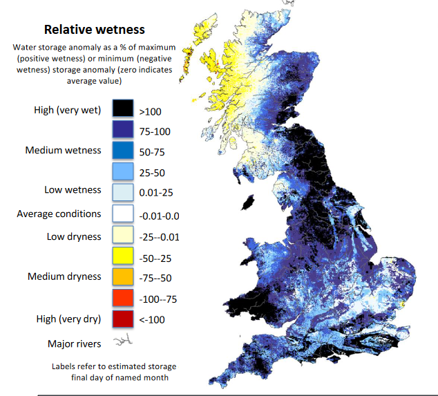
Farmers Free Forecast |

|
|
|
|
|
Disclaimer
Legal terms and restrictions These are the terms and conditions on which you may use metjeffuk.com is used to refer to the Internet domains metjeffuk.com (metjeffuk.com and all of the web pages, mobile web pages, content, web sites and software applications they contain.) Please read carefully and leave the site immediately if you do not agree with any aspect of the legal terms and restrictions. Overview Our long range weather forecasts are currently experimental and are produced using techniques that have not been validated. Our short and medium range weather forecasts (0 to 16 days ahead) make use of data from Numerical Weather Prediction (NWP) models such as the Global Forecast System (GFS).metjeffuk.com accept no liability for any loss howsoever arising from use of this web site, or software, or services acquired from metjeffuk.com. Metjeffuk.com reserves the right to change, remove or add new sections to the site without notice. All features on the site including forecasts and data are provided on an ‘as is’ or ‘if available’ basis. Pages and/or applications provided by metjeffuk.com may not be available or may be displaying out of date information when you access them. Personnel Data Metjeffuk will not and does not ask for personnel data nor does it store any personnel data, metjeffuk is pearly a weather forecasting service. Warranties and limitation of liability Metjeffuk.com content is only for your general information and use and is not intended to address your particular requirements. In particular, metjeffuk.com content does not constitute any form of advice, recommendation, representation, endorsement or arrangement by metjeffuk.com Your use of the web pages provided by metjeffuk.com is at your sole risk. The web site and all data contained within it are provided on as ‘as is’ and ‘as available’ |
